Overview Of The Plan
n recent years, the country has vigorously promoted the intelligent construction and maintenance of transportation infrastructure, explicitly requiring the acceleration of the construction of intelligent monitoring and early warning systems, and promoting the application of intelligent measurement and artificial intelligence technology in the entire process of detection and monitoring, disease diagnosis, and maintenance decision-making, in order to achieve intelligent control and efficient operation and maintenance throughout the entire lifecycle of key infrastructure. Against this backdrop, the demand for high-precision, non-contact, and non-intrusive intelligent detection and smart operation and maintenance technology in the rail transit field has become increasingly urgent. Yuwei Optics, with lidar perception technology as its core and integrating multi-sensor capabilities, has constructed a full-scenario smart rail transit solution encompassing "safety detection - health monitoring
Application Scenarios
Paired with different hardware and software products, it can detect and measure multiple scenarios
-
Rail Transit Digital Twin System
Based on data collected by lidar and multi-sensor fusion, a digital twin model of rail transit is constructed to realize full-element digital mapping and remote intelligent operation and maintenance management.
-
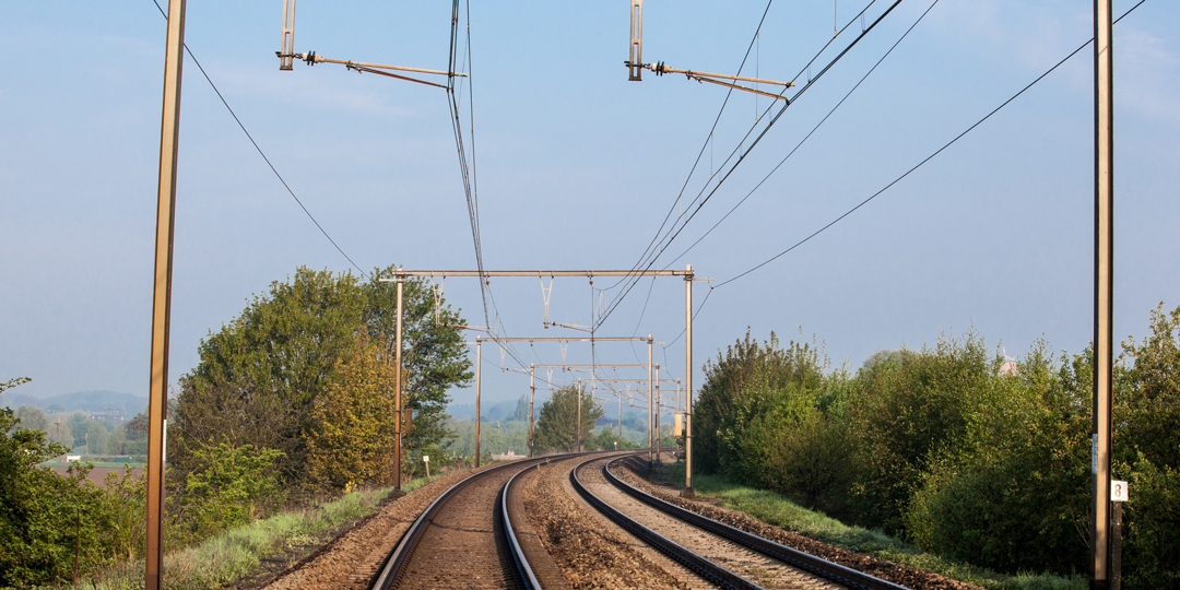
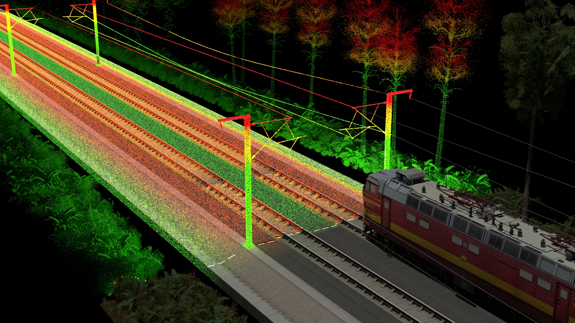
Track clearance safety detection system
By employing a fusion perception system combining lidar and panoramic cameras, the system accurately detects the height of the overhead contact line, surrounding intrusions, and clearance status, automatically identifying safety boundaries and clearance s
-
Analysis of the health status of the track bed
By relying on high-precision lidar to intelligently detect the thickness and slope of the track bed, and to perceive the risk of settlement and foreign objects at the millimeter level, preventive maintenance can be achieved, significantly improving the re
-
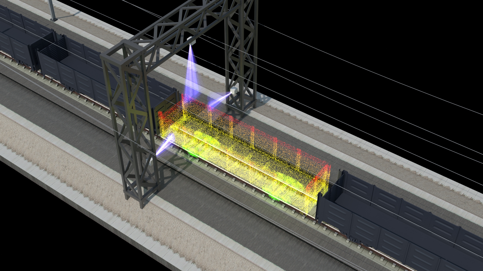
Train carriage inspection
By integrating multiple sensors such as LiDAR, cameras, and line array cameras, it can intelligently detect damage to the carriage and the condition of the cargo and automatically generate reports, empowering freight safety and digital management.
-
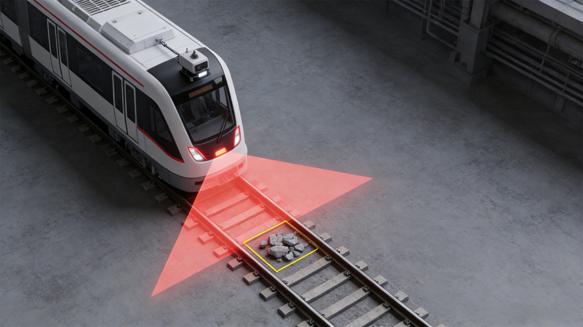
Railway Collision Avoidance Solution
Based on LiDAR perception technology, it accurately monitors the track intrusion risks in low-speed scenarios such as train entering and exiting stations, real-time identifies intruding personnel or items, and effectively prevents collision accidents.
-
Rail culvert settlement analysis system
Based on high-precision scanning by lidar, it accurately monitors millimeter-level settlement changes in railway culverts, intelligently warns of structural risks, replaces manual inspection, and safeguards the long-term safety and stability of the railwa
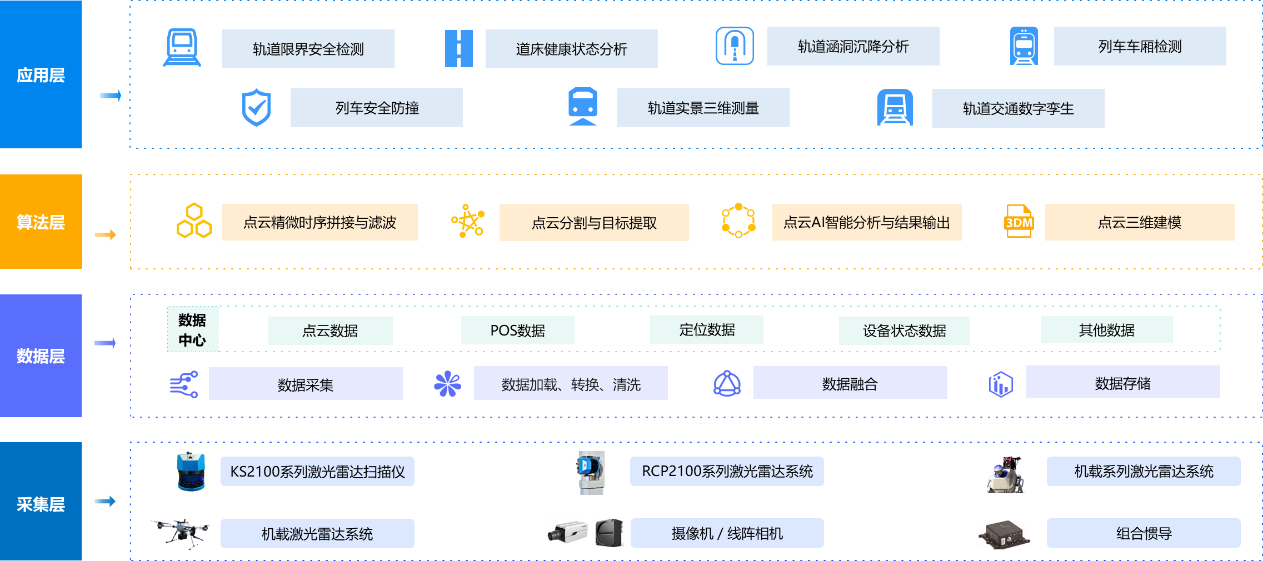
Scheme Architecture
Advantages Of The Plan
Non-contact measurement
Quickly obtain the status of foreign object intrusion on the track to ensure the safety of train operation.Superior environmental adaptability
Unaffected by environmental factors such as lighting and weather, it can operate normally even in extreme weather conditions.High data accuracy results
The inspection route can be planned in advance, and the color point cloud data within the inspection corridor can be output.All core technologies are self-developed
All core technologies are self-developed, ensuring safety and reliability. Customized development of equipment and software can be tailored according to specific industries.
Company Instance
-
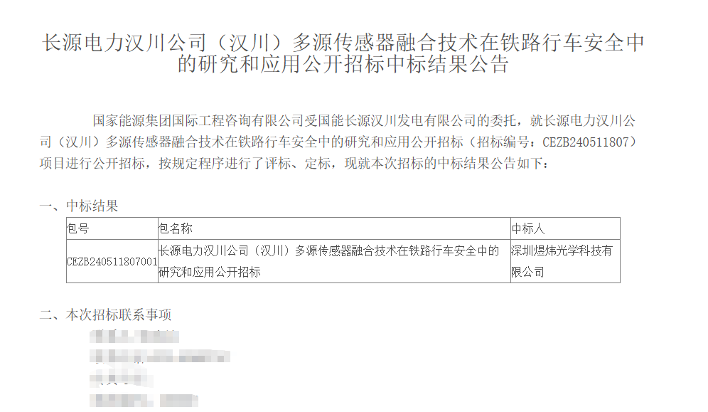
Hanchuan power station Project
-
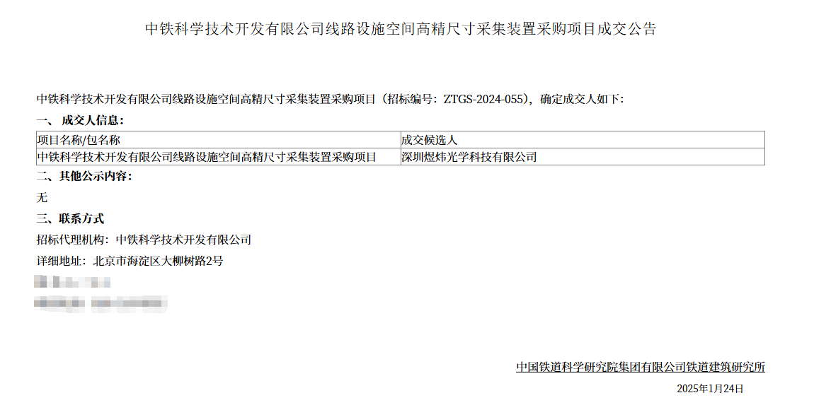
China Railway Science High-precision Dimensional Acquisition Device Project
-
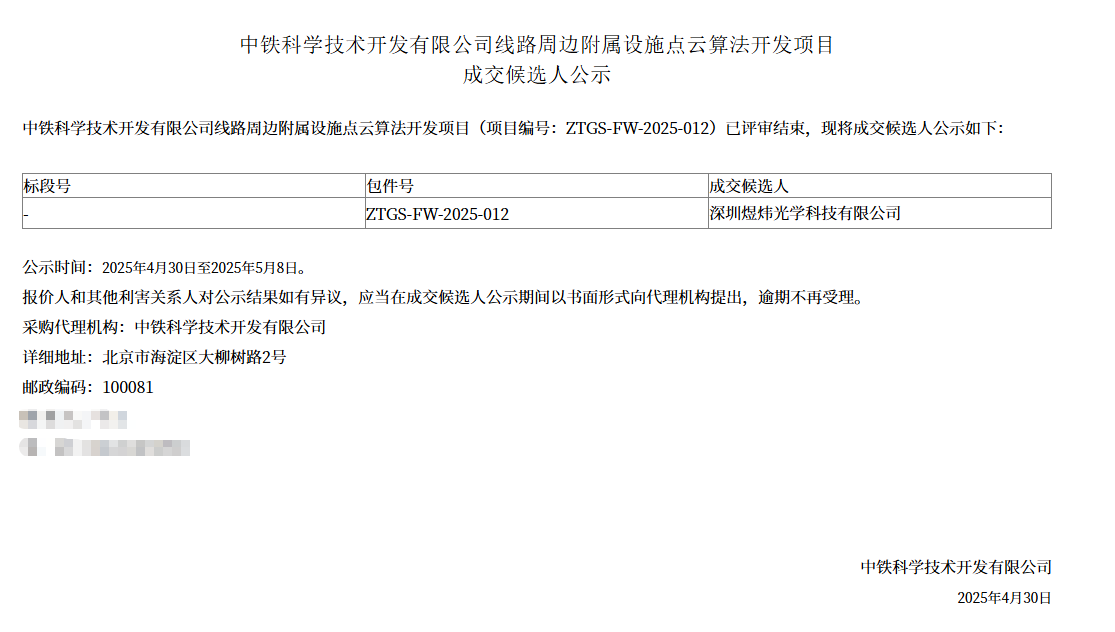
Development project of point cloud algorithm around China Railway Science line
相关产品
-
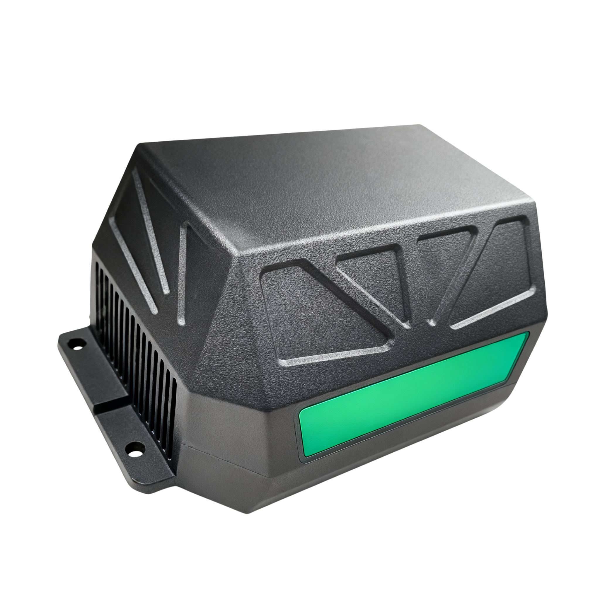
KS9700B Series2D LiDAR scanner
An industrial laser radar suitable for fast-moving carriers, with a scanning frequency of up to 500Hz
MORE
-
RCP21003D LiDAR scanner
Rainproof, dustproof, and corrosion-resistant, it can adapt to various harsh environments and has been widely used in industries such as ports, factories, power, and energy.
MORE
-
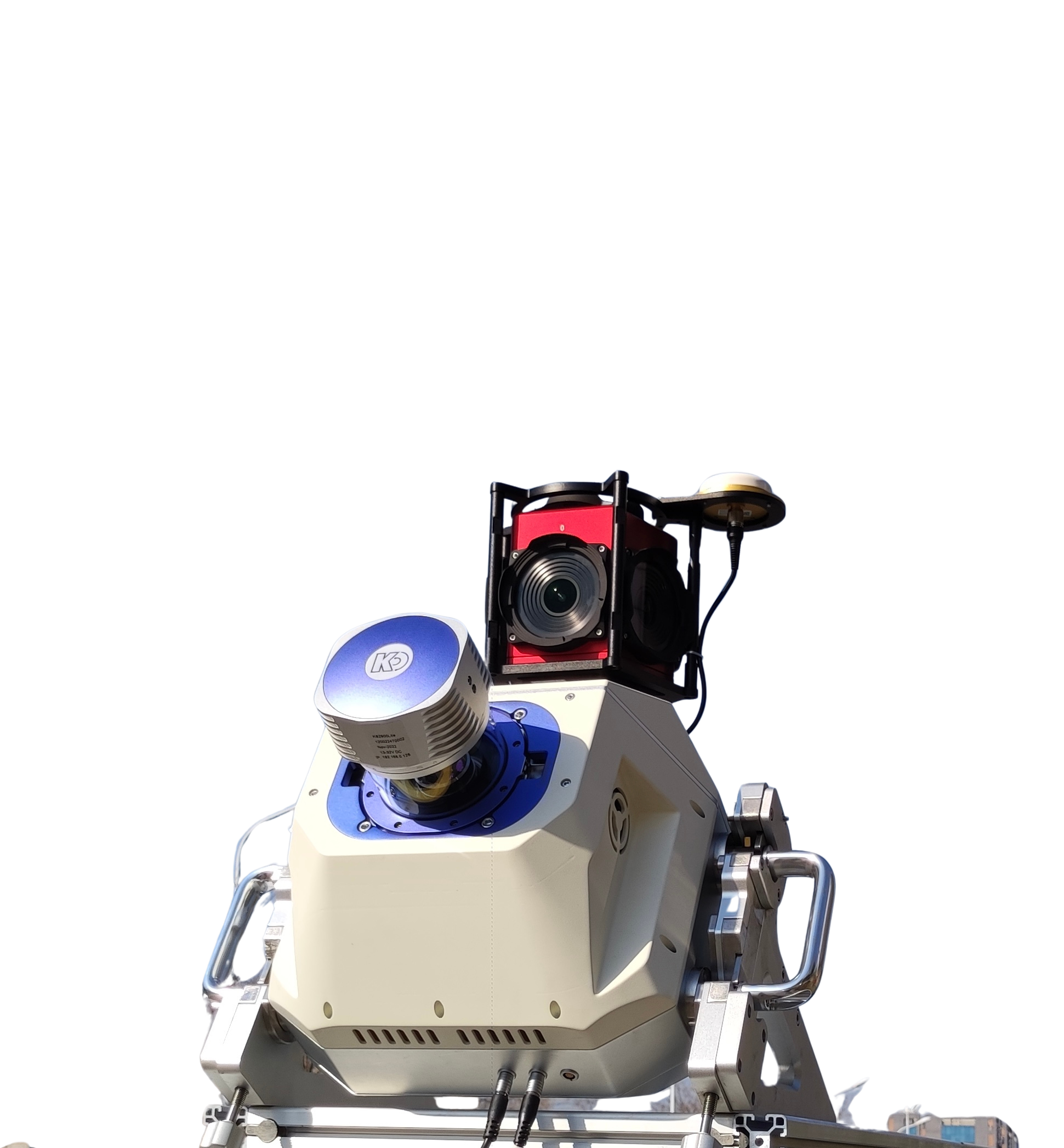
KS2800light detection and ranging
The KS2800 LiDAR measurement system is a high-precision measurement system launched for industries such as surveying and mapping, power, forestry, and emergency response. The multi rotor unmanned aerial vehicle is equipped with a radar system that operates for about 50 minutes. It can plan regional routes, strip routes, cross routes, and ground simulation flight missions based on the operational measurement area, and collect high-precision point cloud raw data; The KMeta series post-processing software can output high-precision LAS point cloud data, which can meet the data needs of various industries.
MORE
-
KS2900OSC in vehicle mobile measurement system
The KS2900-OSC onboard mobile measurement system consists of four parts: an external scanning system, an internal power supply control system, a roof mounting bracket, and data processing software. It can achieve the collection of massive point cloud data and high-precision panoramic camera data, with a lightweight design that is easy to assemble, and is widely used in fields such as highway street surveys and high-precision maps.
MORE