Software Services
"Dedicated to becoming a world leading provider of high-end laser ranging sensors, LiDAR system products, and comprehensive solutions"
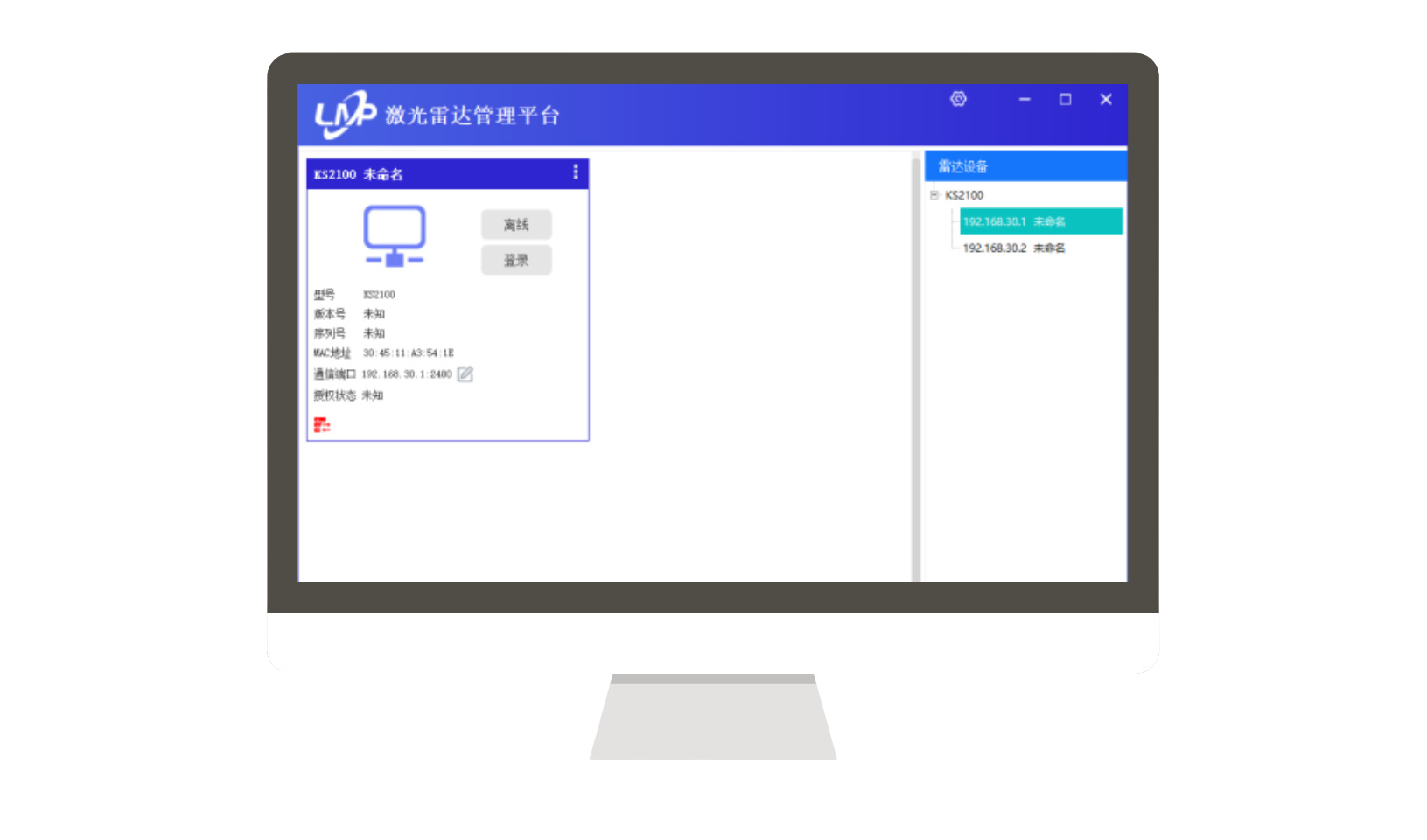
Lidar Management Platform (LMP)
Lidar Management Platform (LMP) is a unified management platform for lidar products, supporting all radar and pan tilt products of the company. Its main functions include:
1. Connect multiple radar devices of different types at once.
2. Real time viewing of the scanning results of radar equipment and performing operations such as scaling and rotating the scanned images.
3. Set polygonal or fan-shaped warning zones for the device.
4. Read/set a series of configurations for radar equipment, including scanning frequency, angular resolution, and scanning angle.
5. View operational status (received frames, network uplink and downlink data, measured nearest and farthest distances)
6. Support multiple users and assign different permissions to different users.
Kmeta 3D data preprocessing software
KMeta is a comprehensive data preprocessing software that mainly includes the following functions:
1. Fusion and solve the collected radar data and inertial navigation data into three-dimensional point cloud data;
2. Inertial navigation data can be separately solved to generate three-dimensional point cloud data.
3. Select, cut, and cut LAS files according to the trajectory.
4. Calculate the placement error of 3D point cloud data.
5. Inspect and analyze 3D point cloud data.
6. Rectify 3D point cloud data.
7. Perform adjustment on the navigation belt.
8. LAS files can be processed for smoothing, filtering, merging, coordinate translation, and generating XYZ files.
KData onboard data acquisition software
KData software is the abbreviation for in vehicle data acquisition system, mainly used for field data collection. It mainly includes online data collection function and map function.
The data collection includes online collection and storage of laser data, IMU data, and camera data, while the map function includes route planning and real-time navigation functions
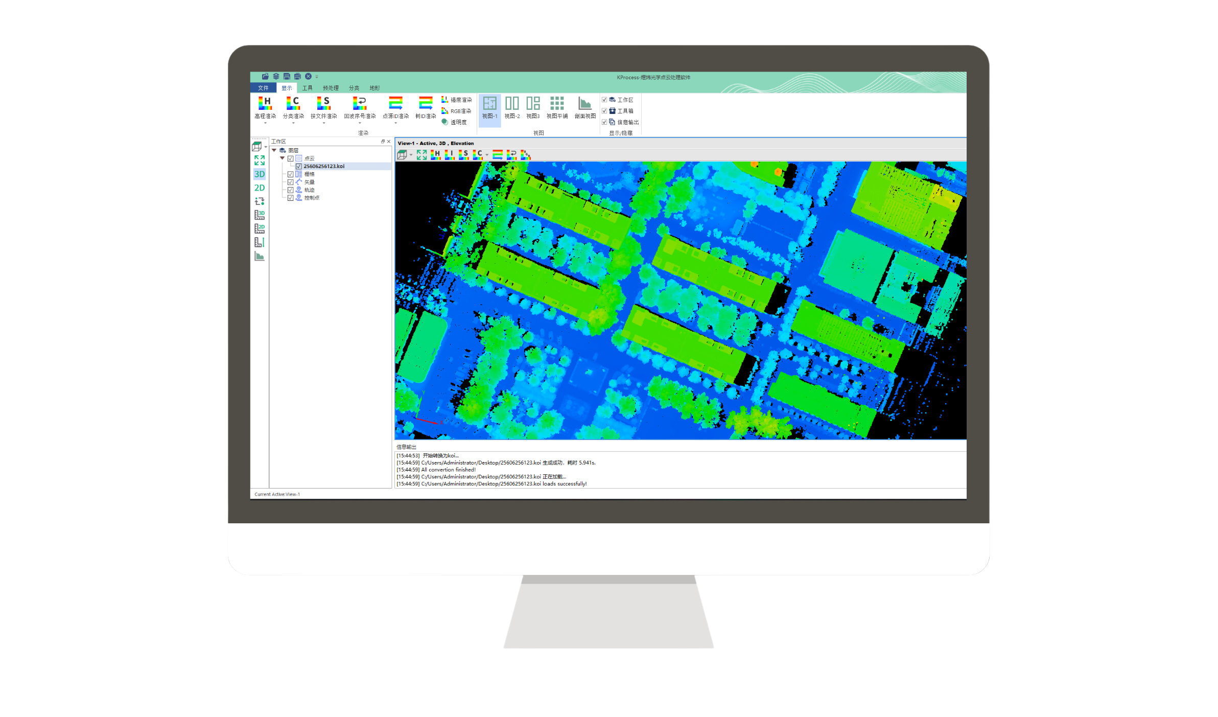
3D data post-processing software KProcess
KPorces is a comprehensive data post-processing software that mainly includes the following functions:
1. Quickly browse and edit 3D point cloud data.
2. Vector, trajectory, orthophoto and other data can be browsed and displayed.
3. Measure, query, crop, and format convert point clouds.
4. Perform basic preprocessing on point cloud data, including calibration, aerial belt adjustment, trajectory correction, etc.
5. Classify airborne point cloud data, including low point, ground point, above ground, and building classification.
6. It can generate terrain products, including DEM and DSM generation.
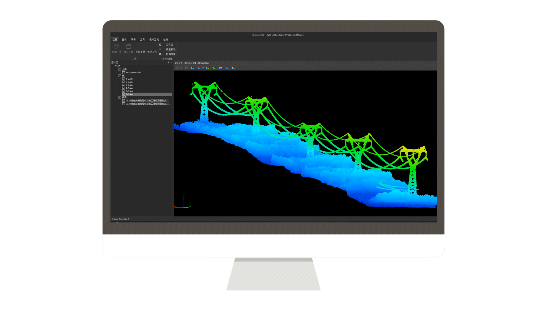
7. Power line plugin, processes point cloud data in the power industry and generates analysis reports.