Overview Of The Plan
By using technologies such as remote sensing, LiDAR, and aerial photography, basic geographic information is provided for the development of the national economy and society, as well as for various departments and professional surveying and mapping of the country. Basic surveying and mapping is widely used in infrastructure construction, agriculture and land management, environmental protection and resource management, construction and real estate, and other fields. Basic surveying and mapping is one of the fundamental tasks of national development, and it is of great significance for improving the level of national economic and social development and ensuring national security.
Application Scenarios
Paired with different hardware and software products, it can detect and measure multiple scenarios
-
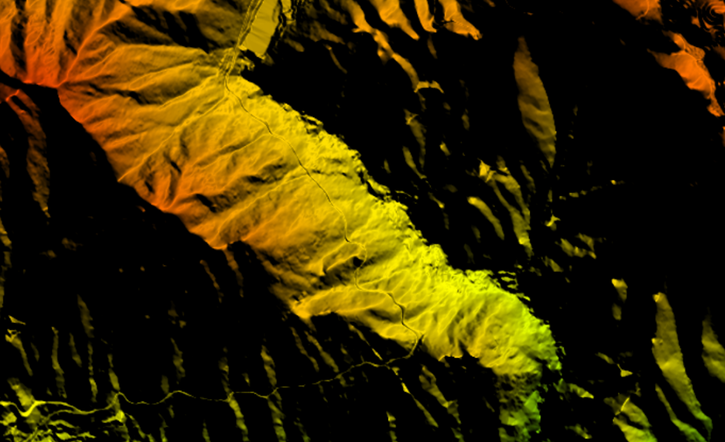
土方测量
工程施工前的设计阶段必须对土石方量进行预算 , 它直接关系到工程的费用概算及方案选优,采用机载激光雷达测量系统,可以对土方精准测量。
-
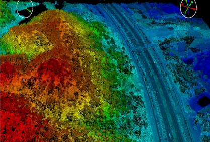
地形图测量
采用机载激光雷达测量系统可实现大面积的高效率测量,精准、安全、快速获取地形三维信息,最终生成DEM\DOM\DLG等成果。
-
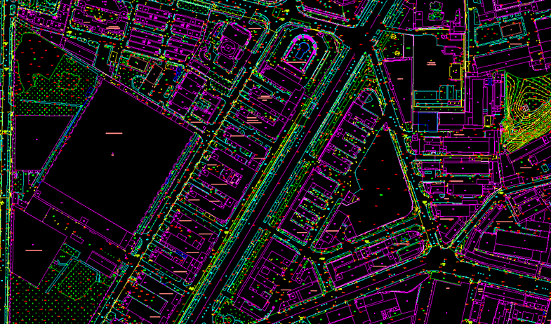
地籍测量
采用机载激光雷达测量系统和车载激光雷达测量系统,实施农村地籍不动产测量,保证不动产单元的界址清楚、面积准确,实现地籍测量。
-
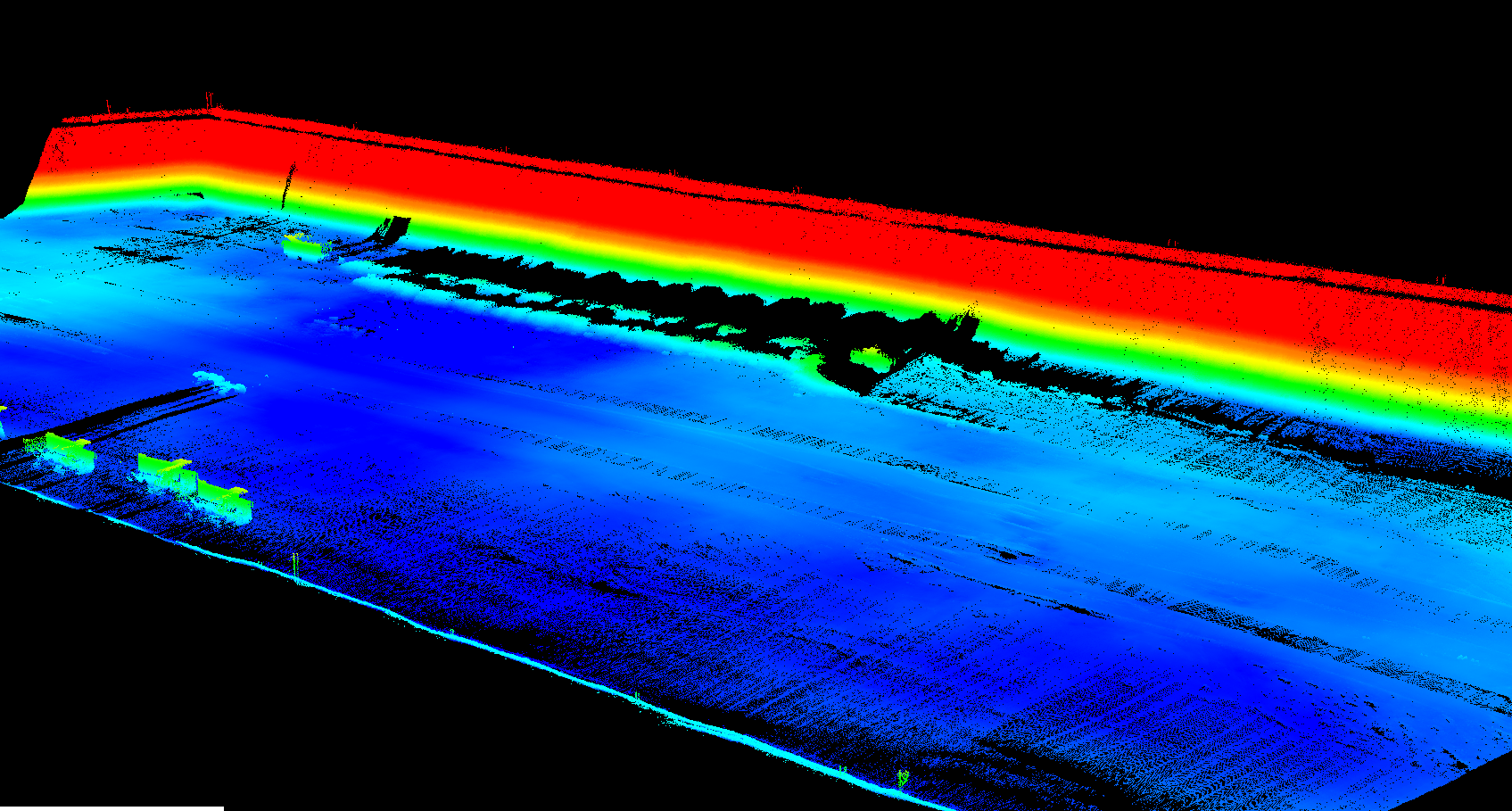
堆体测量
采用机载激光雷达测量系统或手持实时三维重建设备,一体化集成激光雷达、全景相机、高精度惯导等模块,可以实时生成真彩点云模型,让堆体测量更高效、更精准。
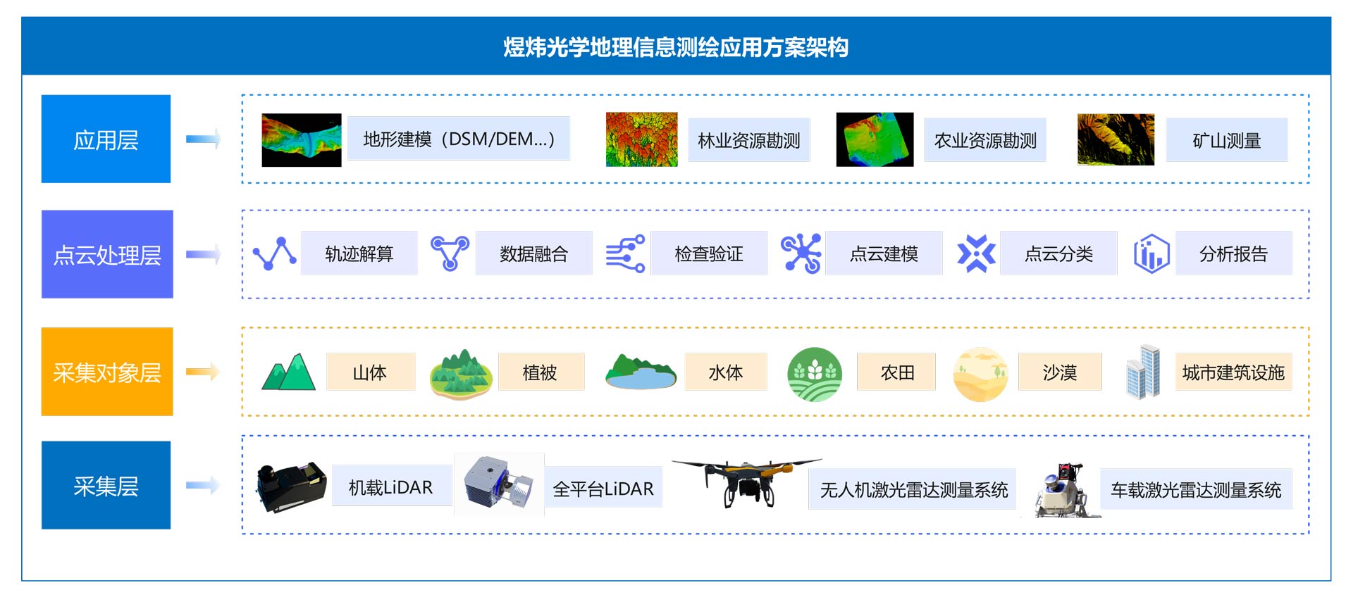
Scheme Architecture
Advantages Of The Plan
-
高效率
激光雷达具有高速扫描能力,可以在短时间内获取大量地形和地物数据,显著提高测绘工作的效率。
-
强穿透
能够穿透植被层获取地表的高程数据同时不受光照及天气条件限制,可在夜间、雨雪、雾等环境下进行测绘作业
-
多平台
可安装在多种平台上,如手持设备、固定设备、无人机、地面车辆、水面船只、航空器等,根据不同的应用需求进行灵活部署。
-
国产化自主可控
国产化自主可控、安全可信,核心技术全部自研,可根据行业进行设备及软件的定制化开发。